How Map Browsing and Annotations Improve Drone Project Reviews
When drone pilots deliver aerial data to clients, the real work starts after the flight. Raw images, even when stitched into orthomosaics or processed into point clouds, can be hard for a client to interpret without guidance. A static PDF report or a folder of TIFF files leaves too much room for questions. That is where a well-designed map viewer with annotation tools changes the workflow. Instead of sending files and waiting for questions, you give clients a browsable, annotated map that answers most of their concerns before they ask.
This approach relies on solid drone data hosting. The platform stores the processed outputs and serves them in a web-based viewer that anyone with a link can open. No special software, no large downloads, no confusion over which file is the final version. The client sees the orthomosaic, the point cloud overlay, or the time-series comparison in one place. They can pan, zoom, and toggle layers on their own. That independence is the first step toward faster project sign-off.
What Map Browsing Adds to a Project Review
A map viewer is not just a picture on a screen. It is an interactive environment where the client can move around the area of interest. They can zoom in on a specific feature, measure a distance, or check the alignment of a new structure against the survey data. For a construction manager reviewing a stockpile volume calculation, being able to rotate the point cloud and examine the slope from every angle is worth more than a dozen email exchanges. For an agricultural consultant looking at a time series of crop health maps, sliding between dates shows exactly where irrigation adjustments worked and where they did not.
The biggest gain is context. A static image shows what was there at one moment. A browsable map shows where that moment fits into the larger site. Clients who can navigate the data themselves tend to spot discrepancies earlier, ask more precise questions, and approve deliverables faster. That reduces the back-and-forth that eats into a pilot's margins.
Annotations Turn Observation into Action
Browsing alone is useful, but annotations make the review collaborative. When a client finds something that needs attention, they can drop a pin, draw a polygon, or add a comment directly on the map. The annotation is tied to coordinates, so there is no confusion about which tree, which trench, or which manhole they mean. The pilot or project manager can reply with their own note, attach a close-up image, or mark the issue as resolved. Everything stays in the map layer, creating a project report that lives and breathes with the data.
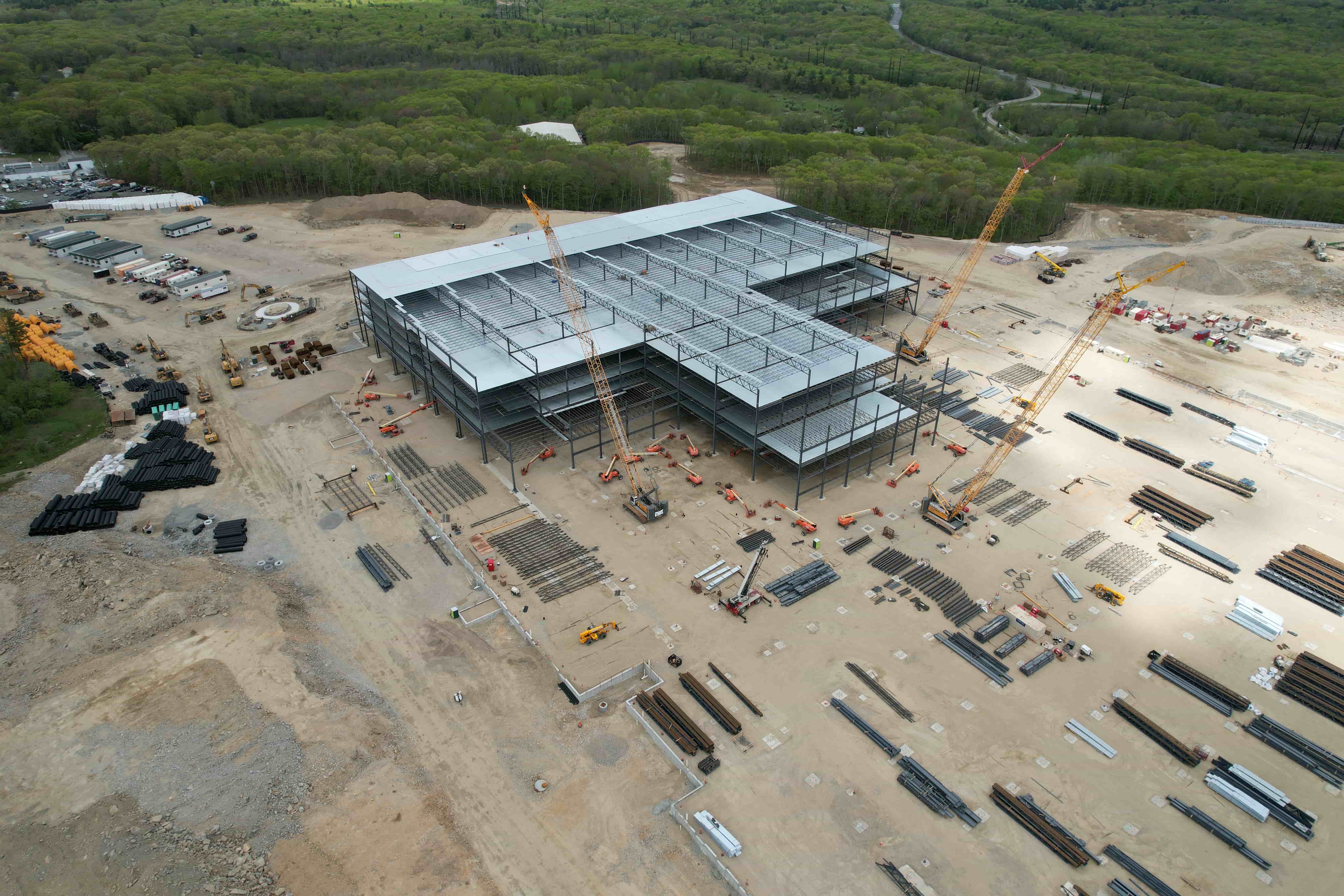
Annotations also serve as a record. If a dispute arises later about whether a certain feature was flagged during the review, the map shows the exact date, time, and author of each note. That traceability is valuable for regulated industries such as mining, environmental monitoring, or infrastructure inspection. It also helps when multiple stakeholders are involved. An engineer can annotate a potential conflict in the orthomosaic, a surveyor can confirm the measurement, and a project manager can sign off. All of it happens inside the same hosted environment, not scattered across emails and spreadsheets.
How the Workflow Fits Together
The process starts with a file upload. The pilot sends the processed data - orthomosaic, point cloud, or time-series rasters - to the drone data hosting platform. The platform processes the files into a format that the map viewer can display. Once the data is ready, the pilot shares a link with the client. No login required for the viewer if the platform allows guest access; otherwise, a simple account creation handles permissions.
The client opens the link and sees the map. They can browse, toggle layers, and take measurements. When they spot something, they add an annotation. The pilot gets a notification and can respond. The entire conversation stays attached to the map. When all annotations are resolved, the project is ready for final approval. The pilot can then export a clean project report that includes the map view and the annotation history. That report becomes the official deliverable.
This workflow depends on the organized delivery of flight data. Without a system that keeps every mission's outputs sorted, annotated, and versioned, the review process gets messy. A client might be looking at an older orthomosaic while the pilot is referencing a newer one. Annotations made on the wrong layer create confusion instead of clarity. A hosting platform that manages versions and access rights prevents those problems before they start.
What to Look for in a Hosting Platform
Not every drone data hosting service offers the same level of map interaction. When evaluating options, consider these capabilities:
- Layer management: Can the viewer show multiple data sets (orthomosaic, point cloud, time series) and let the user toggle them on and off? This is essential for comparison work.
- Annotation tools: Does the platform support pins, freehand drawing, and text comments? Can annotations be resolved or reopened? Is there a history log?
- Measurement functions: Can the client measure distance, area, and volume directly on the map? This reduces the need for external software.
- Access controls: Can you set view-only or annotate-only permissions? Can you revoke access after project completion?
- Export options: Can you generate a project report that includes the map state and annotation history? This is important for record-keeping.
A platform that scores well on these points will save time for both the pilot and the client. It turns the review from a passive read into an active conversation, which usually leads to faster approvals.
Common Pitfalls to Avoid
Even with good tools, the review can stall if the data is not prepared properly. One common mistake is uploading a single massive file without breaking it into logical layers. A client who has to load a 10 GB orthomosaic on a slow connection will not browse much. Instead, create overview tiles and allow progressive loading. Another mistake is skipping annotation training. If the client does not know how to drop a pin or draw a polygon, they will email their observations instead. A short video or a written guide included with the link can fix that.
Another pitfall is neglecting version control. If the pilot updates the orthomosaic after a second flight, the old version should be archived, not deleted. The client might have made annotations on the first version that refer to features that changed. A good hosting platform handles versioning automatically, but the pilot should confirm that the platform keeps a history and does not overwrite data without notice.

Why This Matters for Drone Pilots
For an FAA-certified pilot who works with multiple clients, the ability to host and share data in an interactive map viewer is a competitive advantage. It shows professionalism and reduces the time spent answering basic questions. Clients appreciate being able to explore the data on their own schedule. They also value the transparency of seeing exactly what was measured and where.
The organized delivery of flight data becomes a selling point. When a pilot can say "I will send you a link to a browsable map where you can annotate your feedback directly," the client hears "less email, fewer meetings, faster results." That is the kind of service that builds repeat business and referrals.
Map browsing and annotations are not just nice extras. They are practical tools that make drone project reviews more efficient, more accurate, and more collaborative. Any pilot who processes and delivers aerial data should consider how a good hosting platform and a thoughtful review workflow can improve their bottom line.